 0
0
 0
0
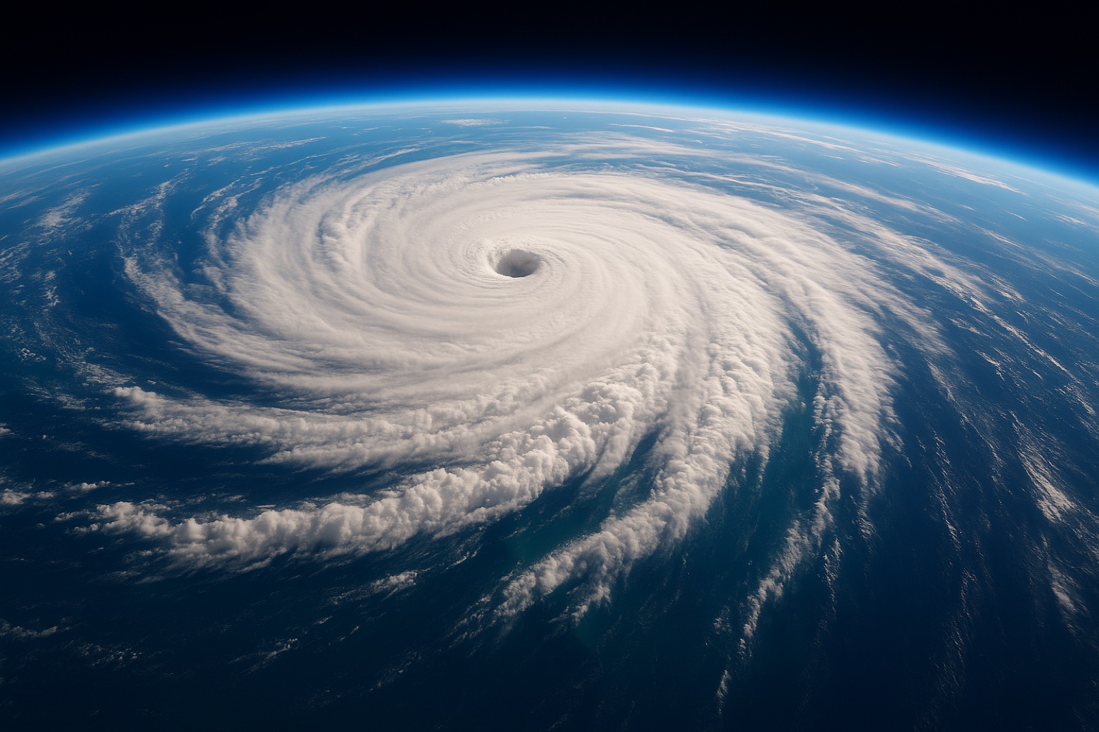
There is a job that involves flying a plane straight into a hurricane on purpose — punching through the wall of wind, crossing the strange calm in the middle, then coming out the far side to turn around and do it again. NOAA’s Hurricane Hunters have been doing it for decades. On every pass, Doppler radar in the aircraft takes a three-dimensional slice of the storm.
All those slices went into an archive. Researchers have now gone back through 28 seasons of it and found something genuinely useful: the signs a hurricane is about to strengthen are usually already sitting there, visible, about a day before the strengthening starts.
Not a hunch. A measurable difference in the storm’s shape.
What 28 Seasons of Flying Into Storms Added Up To
The archive is called TC-RADAR — the Tropical Cyclone Radar Archive of Doppler Analyses with Recentering. It holds 1,510 radar analyses gathered by NOAA hurricane aircraft across 28 hurricane seasons, from 1997 through 2024.
The study built on it was led by Michael S. Fischer at the University of Miami’s Rosenstiel School, working with colleagues at NOAA’s Atlantic Oceanographic and Meteorological Laboratory, and was published this year in the Journal of Geophysical Research: Atmospheres. The paper’s title is a Hamlet joke: “To Align or Not to Align? That Is the Question.”
That joke turns out to be the entire finding.
A Hurricane Has to Stand Up Straight Before It Can Get Strong
Here is the part most storm coverage skips.
A young tropical storm is rarely a neat column. Its circulation near the sea surface and its circulation higher up are often in two different places. The storm is leaning. Forecasters call that tilt.
What pushes it over is vertical wind shear — winds blowing at different speeds or directions at different heights. And a leaning storm leaks. Its rain and its thunderstorms get flung out to one side instead of feeding the middle.
Alignment is when those centres stack up into a single vertical column, surface to sky. And alignment, this research says, comes first.
“A tropical cyclone has to stand up straight before it can intensify.” — Michael S. Fischer
That quietly changes the question a forecaster is asking. It stops being is this storm getting stronger? and becomes is this storm getting straighter? — because the straightening happens first, and it can be seen.
The 4 Signs a Hurricane Is About to Strengthen
The team compared the storms that aligned quickly against the ones that stayed stubbornly tilted. Four differences separated them:
- A tight, compact circulation near the sea surface. Not a wide, sloppy swirl — a small, well-wound one sitting close to the water.
- The lean pointing the right way. Tilt by itself does not doom a storm. A tilt oriented favourably against the wind shear pushing on it gives the storm room to recover.
- Stronger rising air and heavier rain right at the low-level centre. Not scattered around the edges. Concentrated in the middle.
- A friendly neighbourhood. Warm ocean water underneath, plenty of moisture in the air, and relatively weak winds through the middle of the atmosphere.
“The storms that aligned already looked different about a day beforehand,” Fischer said.
A day. In hurricane forecasting, a day is a great deal.
The Part the Researchers Were Careful About
This is the detail worth slowing down for, and it is easy to read straight past.
The third sign — thunderstorms building right over the low-level centre — looks at first like a symptom. The storm is getting organised, so naturally the weather near its middle gets busier. A readout, not a cause.
The researchers suggested it may run the other way too. Those thunderstorms, Fischer noted, “may also help pull the storm’s leaning circulation upright.”
Read that again. The thing that tells you the storm is about to straighten may also be the thing doing the straightening. The signal and the cause could be the same event.
And note the word may. The team did not claim to have proved it. This is radar observation across nearly three decades of flights — it shows what reliably travels with what, which is a strong hint about mechanism rather than a closed case. That caution belongs to the researchers, and it is worth carrying along whenever you repeat the finding.
Why This Matters Far Beyond the Atlantic
Rapid intensification is the forecaster’s nightmare. The standard definition is a jump of at least 30 knots — roughly 55 km/h, or about 35 mph — in a storm’s maximum sustained winds inside 24 hours. A storm can go from something you would keep an eye on to something you would run from between one evening’s news and the next morning’s.
This is not an American problem, either. The same storm is called a hurricane in the Atlantic, a typhoon in the northwest Pacific, and a cyclone around the Indian Ocean and Australia. Same physics, different name. And the people with the least warning and the fewest options are almost always the ones living closest to the water.
The ocean underneath all of this is not a fixed background, either — the centuries-old link between the Indian and Pacific Oceans has recently started to come apart, which changes where rain falls and where it does not.
Which is why Fischer’s framing of the payoff is so modest, and so worth quoting exactly: “Even a modest increase in forecast confidence a day earlier can provide more usable preparation time for communities in a storm’s path.”
Not certainty. Confidence, slightly earlier. That is all it is. It is still enormous.
What a Day’s Warning Is Actually For
It would be easy to read a finding like this as a scolding — look how much we fail to notice. That is not what it says. It says something kinder.
The signs were never hidden. They sat in the radar the whole time, in plain view, for 28 seasons. What was missing was not the information. What was missing was somebody who had flown into enough storms to know what they were looking at. The warning was mercy waiting on a reader.
There is an old strand of thinking, far older than radar, that runs on the same order of operations. It says strength is not the first thing that arrives in a person — alignment is. You do not get strong and then get sorted out. You get sorted out, and the strength is what follows. It has always insisted that God works from the centre outward, on the middle of a person long before anything shows on the outside.
The Hurricane Hunters were not testing any of that. They were measuring tilt. It is just a strange thing to find the same order of operations sitting inside a storm.
What to Do With a Day
If you live anywhere a storm can reach, a day is enough for most of what actually matters, and almost none of it costs money.
- Fill every container you own with drinking water before the pressure drops. Water pressure is also what keeps a pipe clean from the inside — one city found out that 45 minutes without it was enough to need a boil-water advisory.
- Charge whatever holds a charge while there is still power — phone, torch, power bank.
- Put your documents in a sealed plastic bag. ID, papers, anything that is painful to replace. A bag costs nothing.
- Agree on one meeting point and one contact who lives far away. Local phone networks fail first; someone outside the area can relay messages between people who cannot reach each other.
- Move what matters up, not out. There is rarely time to move things away. There is usually time to move them higher.
None of that requires certainty. Waiting for perfect information before you act is its own quiet risk — the same trap as waiting for perfect weather that never arrives.
Most people reading this are not in a storm’s path today. But the shape of the thing travels. The warning almost always exists before the event does, and it almost never announces itself. It tends to look like a small change at the centre of something — a marriage, a body, a job, a mood — while the outside still looks the way it did last week.
You do not have to do anything with that. Nobody is asking you to brace. It is only worth knowing that a day’s notice is a real thing, that it usually comes, and that reading it is a skill people learn by watching the same thing over and over until the difference becomes obvious.
The Hurricane Hunters needed 28 seasons. You have probably had more warning than you think.
Questions People Ask About Hurricanes That Strengthen Fast
What are the signs a hurricane is about to strengthen?
Research on 28 seasons of NOAA Hurricane Hunter radar data identified four features in storms that went on to align and intensify: a tight, compact circulation near the ocean surface; a tilt oriented favourably relative to the vertical wind shear pushing on the storm; stronger rising air and heavier rainfall right at the low-level centre; and a surrounding environment of warm ocean water, abundant moisture, and relatively weak winds through the middle of the atmosphere. These differences were typically visible about a day before the storm aligned.
What does it mean when a hurricane is tilted?
A tilted tropical cyclone has its low-level circulation centre and its mid-level circulation centre in two different places, so the storm leans instead of standing as one vertical column. Vertical wind shear — winds blowing at different speeds or directions at different heights — is what pushes a storm over. A tilted storm struggles to intensify, because its rainfall and rising air get displaced to one side rather than feeding the centre.
How much warning do forecasters get before a hurricane rapidly intensifies?
About a day, according to this research. Michael S. Fischer of the University of Miami’s Rosenstiel School, whose team analysed 1,510 radar analyses collected across 28 hurricane seasons from 1997 to 2024, reported that the storms that aligned already looked different about a day beforehand. That is not a guaranteed forecast — it is a window in which forecaster confidence can improve earlier than it otherwise would.
What counts as rapid intensification in a hurricane?
The standard forecasting definition is an increase in a tropical cyclone’s maximum sustained winds of at least 30 knots — roughly 35 mph, or about 55 km/h — within 24 hours. Storms that do this are particularly dangerous, because a community can be preparing for one strength of storm and be struck by a considerably stronger one.
Are hurricanes, typhoons and cyclones the same thing?
Yes. They are the same kind of storm, named differently by region. A strong tropical cyclone is called a hurricane in the Atlantic and northeast Pacific, a typhoon in the northwest Pacific, and a cyclone in the Indian Ocean and the South Pacific. The physics are identical, and research on how these storms align and intensify applies to all of them.
Over to You
Here is the one worth arguing about. Forecasters now have a signal that arrives roughly a day early — but it raises confidence rather than delivering certainty. Should officials act on a signal like that and risk ordering evacuations that turn out to be unnecessary, or hold out for certainty and risk being late? Tell us which way you would call it in the comments.
Worth Passing On
If any of this was new to you, here are three ways to share it:
- Turns out a hurricane has to stand up straight before it can get strong. Took 28 years of flying planes into storms to work that out — and the warning signs show up about a day early. https://bgodinspired.com/index.php/nature-and-creation/signs-a-hurricane-is-about-to-strengthen/
- The thing that tells you a storm is about to strengthen might also be the thing strengthening it. I have been thinking about that all day. https://bgodinspired.com/index.php/nature-and-creation/signs-a-hurricane-is-about-to-strengthen/
- 1,510 radar passes. 28 hurricane seasons. Pilots flying into the worst weather on earth on purpose, over and over, so that one day somebody would get a day’s warning instead of none. Worth a read: https://bgodinspired.com/index.php/nature-and-creation/signs-a-hurricane-is-about-to-strengthen/