 0
0
 0
0
If you have ever stood in front of an Assyrian carving in a museum — the winged bulls with human faces, the king hunting lions, the rows of soldiers marching along a stone wall — there is a good chance you were looking at something dug out of Nimrud.
Almost all of it came out of one hill.
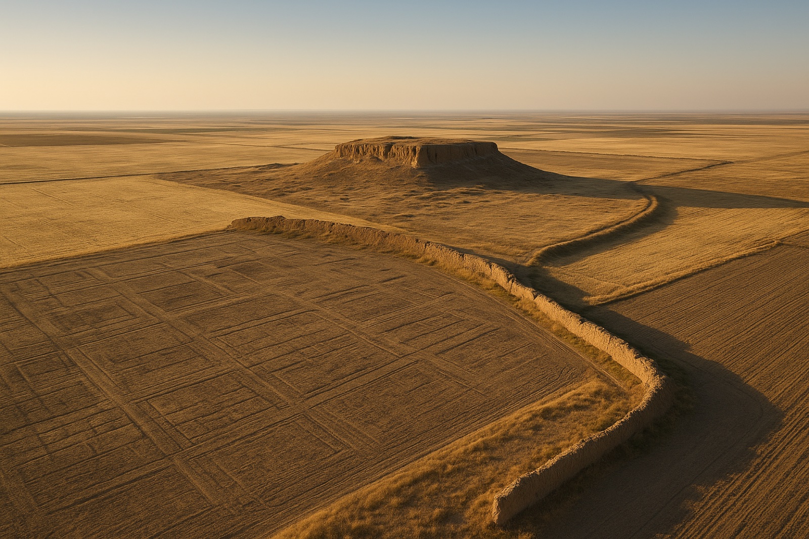
Around that hill is farmland. And under the farmland is the Nimrud lower city: roughly 340 hectares, about 840 acres, of streets and houses and workshops where the ordinary people of an empire actually lived. For 180 years, nobody mapped it.
In 2025, somebody finally did.
What the Nimrud lower city actually is
Nimrud sits in northern Iraq, south of Mosul. The Assyrians called it Kalhu. The Hebrew Bible calls it Calah. In 879 BC a king named Ashurnasirpal II made it the capital of his empire, and it stayed an imperial seat until 707 BC — almost two centuries at the centre of the biggest power in the region.
But a capital is not a palace. A capital is a palace plus everybody who makes the palace possible: the potters, the brickmakers, the traders, the cooks, the people who carried the water and swept the floors and raised their children in the streets below.
That second part is the lower town. At Nimrud it is enormous — 340 hectares, wrapped in nearly 8 kilometres of fortification wall, with monumental gates and towers. It is larger than most complete ancient cities.
And until last year, it was essentially a blank space on the map.
180 years of digging in one small circle
Austen Henry Layard began digging at Nimrud in 1845. He found the palaces, the reliefs, the inscriptions, and the study of Assyria more or less grew out of what came off that hill. Everyone who followed dug in the same place, for an obvious reason: that is where the spectacular things were.
The team behind the new survey put it plainly. Apart from three buildings, the whole lower town — its fortifications, its street system, its residential neighbourhoods, its public buildings, its workshops and its open spaces — has been neglected for 180 years.
It is not quite true that nobody ever tried. An Italian archaeologist, Paolo Fiorina, worked on the topography of the lower town between 1987 and 1989. The First Iraq War stopped him. Decades later another researcher, Jason Ur, studied declassified satellite photographs of the site and pointed out that the lower town clearly had structure — you could see it from orbit — but that nobody had gone and checked it on the ground.
So the honest version of this story is not “nobody noticed.” It is that people noticed twice, and both times the work stopped before it finished.
How they finally mapped it
The 2025 season, run by the University of Udine as the Nimrud Lower Town Archaeological Project, stacked four fairly ordinary methods on top of each other.
- Old spy photographs. Declassified imagery from the U-2, CORONA and HEXAGON missions, taken between 1967 and 1974 — before modern farming and modern damage — already showing fortifications, city gates and a street system.
- A drone and a GPS survey. These produced the first modern topographic map of the whole site: an aerial photo mosaic, a detailed terrain model and a new site plan.
- Walking. The team divided the lower town into a grid of 40-metre squares and walked it, collecting and recording pottery square by square.
- Magnetometry. An instrument that reads tiny differences in the magnetism of soil, run across selected sectors to see what is still buried down there.
The magnetometry showed organised street systems, domestic neighbourhoods and larger building complexes — the buried city matching what the surface had been hinting at all along.
The pottery told a longer story than anyone went looking for. People were living on that ground from the third millennium BC right through to the Islamic period, with the heaviest occupation in the Middle Assyrian, Neo-Assyrian and post-Assyrian phases.
And even out in the farmers’ fields, the kings turned up again. The survey collected inscribed baked bricks and fragments of five different clay prisms belonging to Sennacherib and Ashurbanipal. You cannot get away from them.
Why the ordinary city survived at all
Here is the detail that quietly changes the whole story.
Nimrud was never intensively reoccupied after the Assyrian Empire fell in 612 BC. No later city was built on top of it. And today the lower town is farmland where the ploughing only goes down about 0.2 metres — twenty centimetres — which clips the very top of the archaeology and leaves everything below it alone.
The ordinary city is still down there. Largely intact. Waiting.
It survived precisely because nobody wanted it. There was nothing in it worth carrying off to a museum, so nobody carried it anywhere. The palaces were emptied. The neighbourhoods were ignored — and “ignored” turns out to be another word for “preserved.”
That pattern shows up in archaeology far more often than you would expect. Some of the oldest arrowheads ever found in Central Asia sat unnoticed in material that had already been excavated, simply because they were small and broken and nobody thought they mattered.
There is a harder version of the same point at Nimrud. When ISIS held the site, they destroyed the famous part. The Northwest Palace of Ashurnasirpal II was smashed and blown up in early April 2015. The ziggurat was bulldozed flat between the end of August and the beginning of October 2016. Iraqi forces retook Nimrud on 13 November 2016 and found the monumental core in rubble.
The 340 hectares of ordinary streets around it were not considered worth destroying either.
The king’s canal may not have been the city’s water
One more finding, quieter than the rest, and easy to read straight past.
Ashurnasirpal II, the founder of the capital, built a canal to bring water to it — the Patti-Hegalli. It has long been understood as Nimrud’s water supply: a king’s gift to his own city, running right through the story of how the place worked.
The new topographic data suggests that picture may need substantial reappraisal. The researchers write that a more northerly canal system may have been Nimrud’s principal water source instead.
They are careful about it. Their word is “may,” and more geophysical work, geoarchaeology and excavation are planned to test it properly. But it is a striking possibility: that the thing everyone credited to the king may not have been what actually kept the city alive.
What a city is actually made of
Empires get remembered through their kings, because kings are the ones who commission the carvings. Ashurnasirpal II put himself on nearly every wall of his palace. That is what a palace wall is for.
But the palace was a small fraction of the place. The other 340 hectares were people.
There is a very old story about this same empire’s next capital, and the strange thing about it has always been how it ends. God is arguing with a reluctant prophet about whether that city is worth sparing. And the closing argument is not the king, or the army, or the treasury, or the reliefs. It is a headcount. God counts the ordinary people — including the ones too small to know their right hand from their left — and even the livestock. The king is never mentioned at all.
Three thousand years later, the archaeology is finally being done in the same order.
The part twenty centimetres down
It is easy to assume the parts of a life worth recording are the loud ones. The title. The promotion. The thing you built with your name on it. That is what gets carved into the wall.
But if the last 180 years at Nimrud are any guide, the wall is the part that gets smashed, and the ordinary neighbourhood twenty centimetres under the wheat is the part that survives.
Ordinary people leave faint traces. Sometimes almost nothing at all — at one Anglo-Saxon cemetery, the bodies had dissolved so completely that all the archaeologists recovered were outlines in the sand where people used to be. Faint is not the same as gone.
The Udine team is going back. More magnetometry, geoarchaeology, targeted soundings, open-area excavation. Somewhere under that farmland are houses where people ate dinner and argued and slept and got up the next morning and did it again, and for the first time in nearly two centuries somebody is going to go and look at them.
Which is a strange thing to find moving, and yet. If you are curious how many of those unremarkable days you have had yourself, we built a free tool that works out how many days you have been alive. It is a much bigger number than most people guess.
The survey was published in the journal Antiquity and is free to read in full.
Questions people ask about the Nimrud lower city
What is the Nimrud lower city?
The Nimrud lower city, or lower town, is the roughly 340-hectare residential and working area of the ancient Assyrian capital Nimrud in northern Iraq, surrounding the raised acropolis where the royal palaces stood. It was enclosed by nearly 8 kilometres of fortification walls and contained streets, houses, workshops, public buildings and open spaces. Unlike the palaces, it went almost entirely unexcavated for 180 years.
Why did archaeologists ignore Nimrud’s lower city for so long?
Excavation at Nimrud began with Austen Henry Layard in 1845 and concentrated on the acropolis, where the palaces, monumental buildings, carved stone reliefs and royal inscriptions were. Those finds were spectacular and museum-ready, so subsequent expeditions kept returning to the same ground. One attempt to survey the lower town, by Paolo Fiorina between 1987 and 1989, was halted by the First Iraq War.
How was the Nimrud lower city finally mapped?
The Nimrud Lower Town Archaeological Project of the University of Udine, led by Daniele Morandi Bonacossi and Francesca Simi, combined four methods during its 2025 field season: analysis of declassified U-2, CORONA and HEXAGON satellite and aerial imagery from 1967 to 1974; a drone and differential GPS survey producing the first modern topographic map of the site; an intensive walking survey on a 40-metre grid collecting pottery; and magnetometry in selected sectors. The results were published in the journal Antiquity in 2026.
Is Nimrud the same as the Calah mentioned in the Bible?
Nimrud is generally identified with the city the Assyrians called Kalhu and the Hebrew Bible calls Calah, listed among the cities of the Assyrian heartland. It is a separate site from Nineveh, which lies about 30 kilometres to the north near modern Mosul and became the Assyrian capital later.
Was Nimrud destroyed by ISIS?
Parts of it were. ISIS demolished the Northwest Palace of Ashurnasirpal II in early April 2015 and bulldozed the site’s ziggurat between the end of August and the beginning of October 2016. Iraqi forces retook Nimrud on 13 November 2016. The destruction was concentrated on the monumental acropolis; the surrounding lower town, which had never been excavated, was not a target and remains largely intact beneath farmland.
A question worth arguing about
If you could fund one more season at Nimrud, would you spend it stabilising what is left of the palaces that ISIS destroyed — or excavating the ordinary neighbourhoods that nobody has ever seen? One is rescue. One is discovery. There is not enough money for both. Tell us which one you would choose, and why.
Share this
- Archaeologists dug Nimrud’s palaces for 180 years. Nobody mapped the 340 hectares next door where the actual city lived. In 2025 someone finally walked it — and it is all still down there, twenty centimetres under a wheat field. https://bgodinspired.com/index.php/bible-resources/bible-history/nimrud-lower-city-mapped/
- The best part of this: Nimrud’s ordinary neighbourhoods survived because nobody wanted them. Nothing worth putting in a museum, so nobody dug them up. Ignored turned out to mean preserved. https://bgodinspired.com/index.php/bible-resources/bible-history/nimrud-lower-city-mapped/
- ISIS destroyed the palaces at Nimrud. They did not bother with the 340 hectares of ordinary streets around them — which is the only reason that part of the city is still there to find. https://bgodinspired.com/index.php/bible-resources/bible-history/nimrud-lower-city-mapped/